 NGDC for Kenya
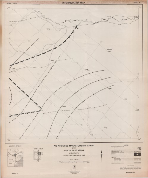
Sheet 21 Total Magnetic Intensity Contour Map
Sheet 21 Total Magnetic Intensity Contour Map
Simple
- Date (Publication)
- 1982
- Edition
-
1
- Presentation form
- Digital map
- Collective title
-
Airborne Geophysical Survey
- Status
- Completed
- Maintenance and update frequency
- Not planned
- Keywords
-
-
Geophysics
-
- Use limitation
-
Internal Only
- Access constraints
- Other restrictions
- Other constraints
-
Internal Only
- Other constraints
- No specifed conditions apply
- Denominator
- 125000
- Metadata language
- English
- Topic category
-
- Geoscientific information
- Begin date
- 1981
- End date
- 1982
- Description
-
North East Kenya
- Supplemental Information
-
{"Translation Needs":"",
"Number of pages (Hardcopy)":"",
"Archive Location (Hardcopy)":"",
"Location in Archive (Hardcopy)":"",
"Risk and Impact":"",
"Vital asset to the organisation?":"",
"Current Asset Volume":"3.61",
"Digitalizing status":"Scanned",
"Scanned Date":"",
"Name of Staff Scanning":"",
"Digital Asset location":" http://gdcs1.gdc.com/SpatialData/Raster/Geological/Airborne_Geophysical_Survey/North_East_Kenya/Sheet_21_Total_Magnetic_Intensity_Contour_Map.jpg",
"Retention period":"",
"Shared with":"",
"Comments":""}
- Distribution format
-
-
.jpg
()
-
.jpg
()
- OnLine resource
- Sheet 21 Total Magnetic Intensity Contour Map
- Statement
-
This data was captured as a stand alone project. The survey was flown by the West German companyGeosurvey International G.m.b.H. This surver data has not been revisted or updated and is stored as scanned versions of the original paper maps.
- File identifier
- 449f17d7-fd86-415e-92d8-ed82053c4dad XML
- Metadata language
- English
- Parent identifier
-
Airborne Geophysical Survey
Airborne Geophysical Survey
- Hierarchy level
- Dataset
- Date stamp
- 2019-10-17
- Metadata standard name
-
National Geodata Centre for Kenya Schema
- Metadata standard version
-
1.0
Overviews
Spatial extent
Provided by
