 NGDC for Kenya
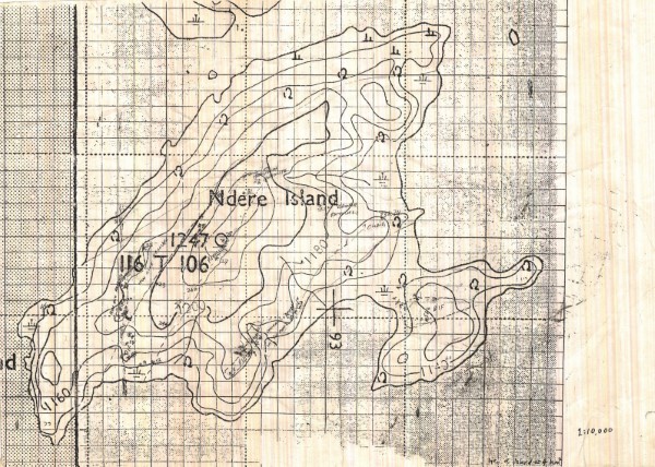
Sketch Map of Ndere Island
Sketch map with hand written notes indicating rock types for Ndere Island
Simple
- Date (Publication)
- Edition
-
1
- Presentation form
- Digital map
- Status
- Completed
- Maintenance and update frequency
- Not planned
- Keywords
-
-
Geology
-
- Use limitation
-
Internal Only
- Access constraints
- Other restrictions
- Other constraints
-
Internal Only
- Other constraints
- No specifed conditions apply
- Denominator
- 10000
- Metadata language
- English
- Topic category
-
- Geoscientific information
- Description
-
Ndere Island
- Supplemental Information
-
{"Translation Needs":"",
"Number of pages (Hardcopy)":"",
"Archive Location (Hardcopy)":"",
"Location in Archive (Hardcopy)":"",
"Risk and Impact":"",
"Vital asset to the organisation?":"",
"Current Asset Volume":"",
"Digitalizing status":"Scanned",
"Scanned Date":"",
"Name of Staff Scanning":"",
"Digital Asset location":" http://gdcs1.gdc.com/spatialdata/raster/geological/scale_1_10000/ndere_island.jpg",
"Retention period":"",
"Shared with":"",
"Comments":""}
- Distribution format
-
-
.jpg
()
-
.jpg
()
- OnLine resource
-
Sketch Map of Ndere Island
Sketch map with hand written notes indicating rock types for Ndere Island
- Statement
-
No details are available as to the source of the map. It may represent field notes from a survey however no further details are available. Scanned copy of published paper map
- File identifier
- 4bbd50e3-3980-4b25-be33-7cb093c2021c XML
- Metadata language
- English
- Hierarchy level
- Dataset
- Date stamp
- 2019-10-14
- Metadata standard name
-
National Geodata Centre for Kenya Schema
- Metadata standard version
-
1.0
Overviews
Spatial extent
Provided by
