 NGDC for Kenya
135000
Type of resources
Topics
Keywords
Contact for the resource
Provided by
Formats
Update frequencies
status
Scale
-
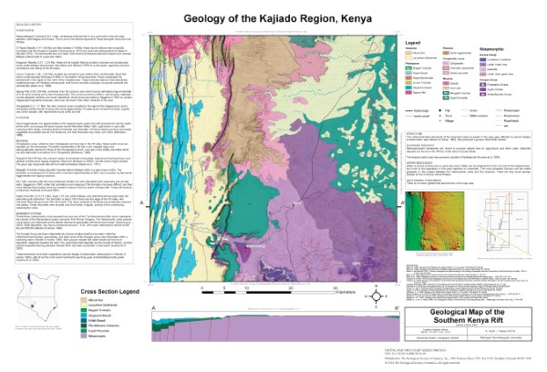
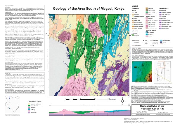
Series of maps showing the southern part of the Kenya rift valley. Map data was collected at various scales but maps are presented to be printed at 1: 135 000 if the pdf versions are printed at 36x24 inches. Maps show bedrock geology and structural elements and include a section of the DEM with hillshading and a cross section.
-
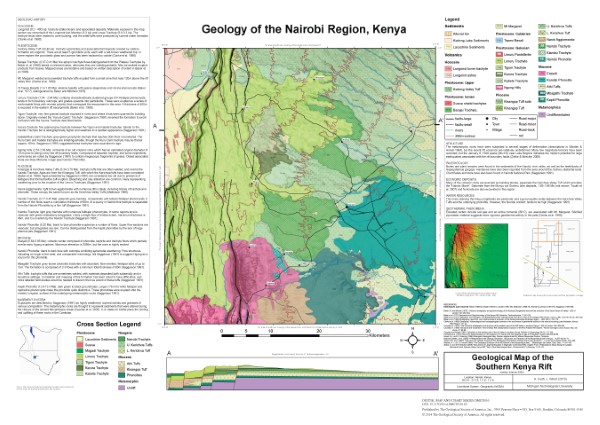
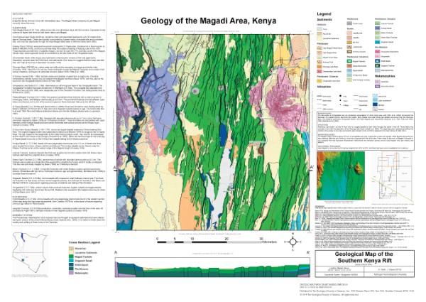
Series of maps showing the southern part of the Kenya rift valley. Map data was collected at various scales but maps are presented to be printed at 1: 135 000 if the pdf versions are printed at 36x24 inches. Maps show bedrock geology and structural elements and include a section of the DEM with hillshading and a cross section.
-
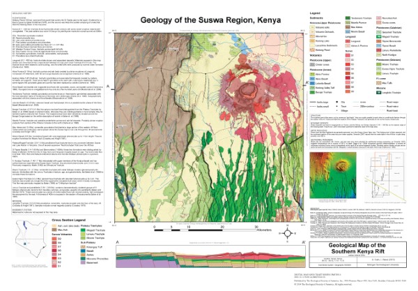
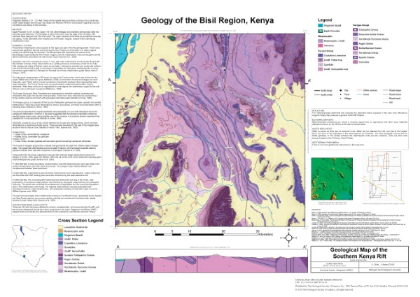
Series of maps showing the southern part of the Kenya rift valley. Map data was collected at various scales but maps are presented to be printed at 1: 135 000 if the pdf versions are printed at 36x24 inches. Maps show bedrock geology and structural elements and include a section of the DEM with hillshading and a cross section.