 NGDC for Kenya
Geology
Type of resources
Topics
Keywords
Contact for the resource
Provided by
Formats
Update frequencies
status
Scale
-
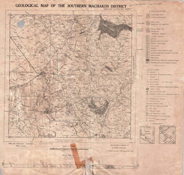
Degree Sheet: 52 SW, Sheet Number (Directorate of Overseas Survey): Not applicable, Report: Not applicable
-
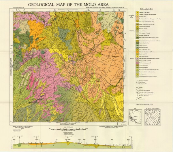
Geological mapping (1984) was carried out as part of the Samburu Marsabit Geological Mapping and Mineral Exploration Prokect, a joint Kenyan - British Overseas Development Administration Technical Co-operation Project, staffed by the Kenyan Mines and Geological Department and the Brtish Geological Survey (formerly the Institute of Geological Science) of Natural Environment Research Council. Series of 1: 250 000 scale geological maps captured in two phases. The maps cover central (phase 1) and northern Kenya (phase 2). The maps align with the 1: 500 000 scale map for the Northern Turkana area.
-
Degree Sheet: 66 NE and 67 NW, Sheet Number (Directorate of Overseas Survey): 192 and 193, Report: Not applicable
-
Degree Sheet: 53 SW, Sheet Number (Directorate of Overseas Survey): 164, Report: Not applicable
-
Degree Sheet: 39, Sheet Number (Directorate of Overseas Survey): 39, Report: Not applicable
-
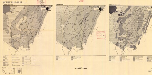
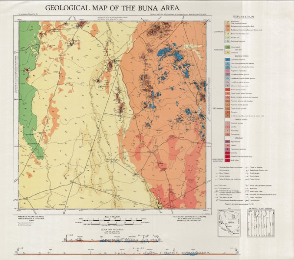
Degree Sheet: 69, Sheet Number (Directorate of Overseas Survey): Not applicable, Report: 24
-

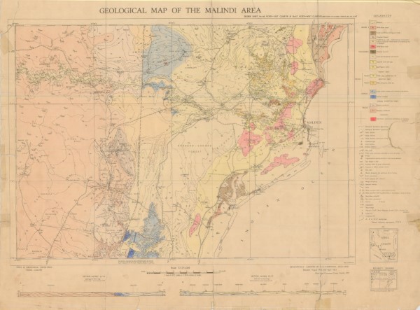
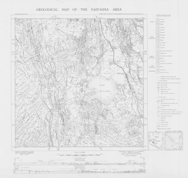
Degree Sheet: 60 NW, Sheet Number (Directorate of Overseas Survey): 175, Report: 52
-
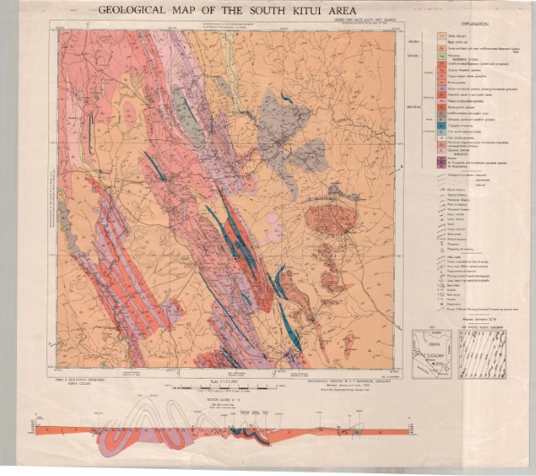
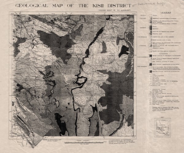
Degree Sheet: 43 SW, Sheet Number (Directorate of Overseas Survey): 133, Report: 55
-
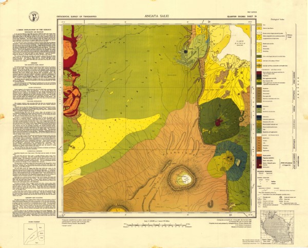
Degree Sheet: 41 SE, Sheet Number (Directorate of Overseas Survey): Not applicable, Report: Not applicable
-
Degree Sheet: 42 NE, Sheet Number (Directorate of Overseas Survey): 118, Report: 86