 NGDC for Kenya
Keyword
Geomorphology
Type of resources
Topics
Keywords
Contact for the resource
Provided by
Formats
Update frequencies
status
Scale
From
1
-
1
/
1
-
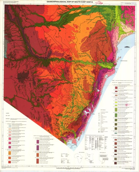
Map showing a range of geomorphology environments across south east Kenya. These include areas formed in a littoral, paralic, denudational, volcanic and fluvial environments. These are shown for coastal, interior hills and plateaus, interior plains and coastal hills and plateaus. Map is part of the Coast Province Geoscience Project financed by the Netherlands Foundation for the Advancement of Tropical Research (WOTRO).