 NGDC for Kenya
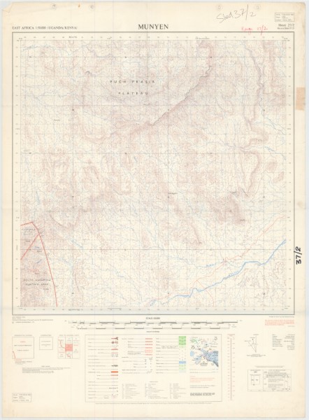
Munyen (37)27 (2)2
Y732 (1: 50 000 scale) Topographic Maps area a series of maps produced by the Uganda Governemnt between 1963 and 1972. The maps cover the interbational boundary area between Kenya and Uganda. Previous versions of the maps have been published and it is possible that further editions have been released. The list contains those maps from the series currently (November 2018) held by the Geodata Centre.
Simple
- Date (Publication)
- 1972
- Edition
-
1
- Presentation form
- Digital map
- Collective title
-
Y732 (1: 50 000 scale) Topographic Maps
- Status
- Completed
- Maintenance and update frequency
- Not planned
- Keywords
-
-
Topography
-
50k
-
- Use limitation
-
Internal Only
- Access constraints
- Other restrictions
- Other constraints
-
Internal Only
- Other constraints
- No specifed conditions apply
- Denominator
- 50000
- Metadata language
- English
- Topic category
-
- Imagery base maps earth cover
- Description
-
Munyen area
))
- Supplemental Information
-
{"Translation Needs":"",
"Number of pages (Hardcopy)":"",
"Archive Location (Hardcopy)":"",
"Location in Archive (Hardcopy)":"",
"Risk and Impact":"",
"Vital asset to the organisation?":"",
"Current Asset Volume":"6.22",
"Digitalizing status":"Scanned",
"Scanned Date":"",
"Name of Staff Scanning":"",
"Digital Asset location":" http://gdcs1.gdc.com/SpatialData/Raster/Topographic/Scale_1_50000_Series_Y732/37_2_Munyen.JPG",
"Retention period":"",
"Shared with":"",
"Comments":""}
- Reference system identifier
- 4210
- Distribution format
-
-
.jpg
()
-
.jpg
()
- OnLine resource
-
Munyen (37)27 (2)2
Y732 (1: 50 000 scale) Topographic Maps area a series of maps produced by the Uganda Governemnt between 1963 and 1972. The maps cover the interbational boundary area between Kenya and Uganda. Previous versions of the maps have been published and it is possible that further editions have been released. The list contains those maps from the series currently (November 2018) held by the Geodata Centre.
- Statement
-
Previous versions of these maps have been issued. The collection represnets those maps held by the Geodata Centre.
- File identifier
- 5813ff46-9cfb-4e5f-a59b-10c456326e2a XML
- Metadata language
- English
- Parent identifier
-
Y732 (1: 50 000 scale) Topographic Maps
Y732 (1: 50 000 scale) Topographic Maps
- Hierarchy level
- Dataset
- Date stamp
- 2019-10-22
- Metadata standard name
-
National Geodata Centre for Kenya Schema
- Metadata standard version
-
1.0
Overviews
Spatial extent
Provided by
