 NGDC for Kenya
Type of resources
Topics
Keywords
Contact for the resource
Provided by
Formats
Update frequencies
status
Scale
-
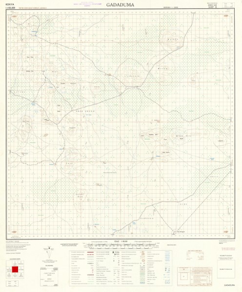
Series of 1: 100 000 scale topographic maps pubished between 1958 and 1978. Data was collated and published by War office and Air Ministry (United Kingdom) subsequently Ministry of Defence (United Kingdom)[GSGS]; Survey Kenya [SK]; Directorate of Overseas Surveys for the Kenya Government [D.O.S.] . Maps are projected using the East African Grids (Transverse Mercator(Clarke 1880); Arc (1960) (Clarke 1880). A small number of the maps are shown as using Arc (1950) (Clarke 1880) however, this dataum is usually used for map in Botswana, Malawi, Zambia and Zimbabwe. The map references for the sheets indicated to be in Arc (1950) (Clarke 1880) have been flagged to indicate this. Publishers: G.S.G.S. British War Office and Air Ministry/Ministry of Defence (United Kingdom); D.O.S. Directorate of Overseas Surveys for the Kenya Government; S.K Survey Kenya
-
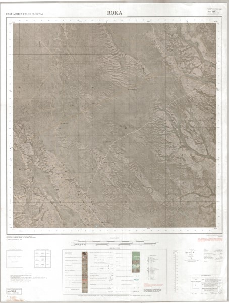
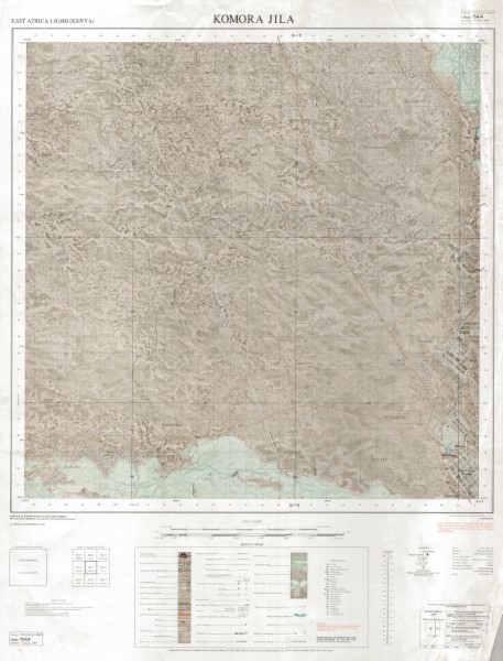
Y731 (1: 50 000 scale) Topographic Maps represents the main 1: 50 000 scale mapping covering large parts of Kenya. The maps illustrate the key topographic features both natural and man made. There have been multiple versions of the maps published. Not all versions of the maps are held by the Geodata Centre. Those which are currently held (November 2018) are listed. Publishers OSD Government of the United Kingdom (Crown Copyright); OSD(K) Government of the United Kingdom for the Government of Kenya; OSD(T) Government of the United Kingdom for the Government of Tanzania; OSD(U) Government of the United Kingdom; USD Department of Land and Surveys Uganda; ING French National Geographic Institute for the Government of Kenya; JICA Japan International Co-operation Agency for the Government of Kenya.
-
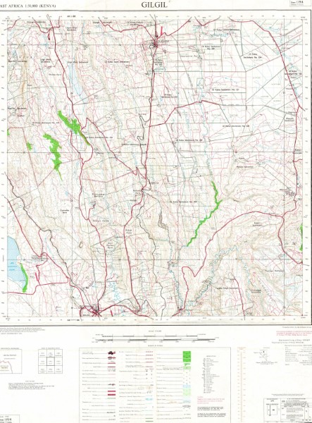
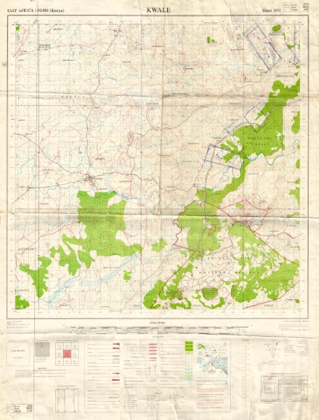
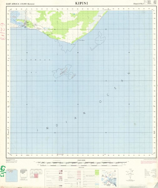
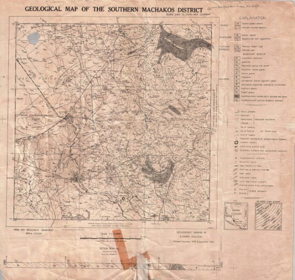
Degree Sheet: 52 SW, Sheet Number (Directorate of Overseas Survey): Not applicable, Report: Not applicable
-
Y731 (1: 50 000 scale) Topographic Maps represents the main 1: 50 000 scale mapping covering large parts of Kenya. The maps illustrate the key topographic features both natural and man made. There have been multiple versions of the maps published. Not all versions of the maps are held by the Geodata Centre. Those which are currently held (November 2018) are listed. Publishers OSD Government of the United Kingdom (Crown Copyright); OSD(K) Government of the United Kingdom for the Government of Kenya; OSD(T) Government of the United Kingdom for the Government of Tanzania; OSD(U) Government of the United Kingdom; USD Department of Land and Surveys Uganda; ING French National Geographic Institute for the Government of Kenya; JICA Japan International Co-operation Agency for the Government of Kenya.
-
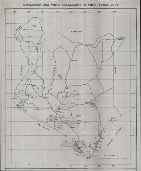
Exploration and Mining Concessions 2008
-
Y731 (1: 50 000 scale) Topographic Maps represents the main 1: 50 000 scale mapping covering large parts of Kenya. The maps illustrate the key topographic features both natural and man made. There have been multiple versions of the maps published. Not all versions of the maps are held by the Geodata Centre. Those which are currently held (November 2018) are listed. Publishers OSD Government of the United Kingdom (Crown Copyright); OSD(K) Government of the United Kingdom for the Government of Kenya; OSD(T) Government of the United Kingdom for the Government of Tanzania; OSD(U) Government of the United Kingdom; USD Department of Land and Surveys Uganda; ING French National Geographic Institute for the Government of Kenya; JICA Japan International Co-operation Agency for the Government of Kenya.
-
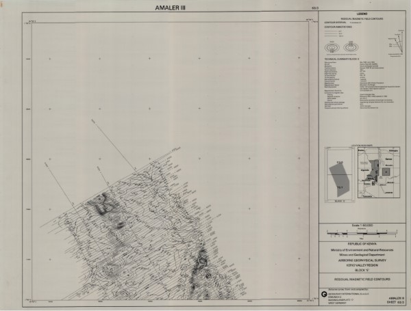
Residual Magnetic Field Contours 63 3
-
Y731 (1: 50 000 scale) Topographic Maps represents the main 1: 50 000 scale mapping covering large parts of Kenya. The maps illustrate the key topographic features both natural and man made. There have been multiple versions of the maps published. Not all versions of the maps are held by the Geodata Centre. Those which are currently held (November 2018) are listed. Publishers OSD Government of the United Kingdom (Crown Copyright); OSD(K) Government of the United Kingdom for the Government of Kenya; OSD(T) Government of the United Kingdom for the Government of Tanzania; OSD(U) Government of the United Kingdom; USD Department of Land and Surveys Uganda; ING French National Geographic Institute for the Government of Kenya; JICA Japan International Co-operation Agency for the Government of Kenya.